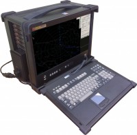
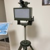
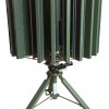
Purpose:
- representation of information about aerial situation revealed by “Malachite” radar
- connection to Automated Command Center
- documenting
The Remote Workplace is able to transfer (if necessary) data to 3 (three) similar Workplaces.
The Remote Workplace performs:
- receiving of video data and data about radar plots after preliminary processing of radar signal
- receiving of data after secondary processing of radar signal
- time synchronization with M5.1 and M5.2 of “Malachite” radar
- representation in different scales (400, 350, 300, 250, 200, 150, 100, 50, 25 km):
- video data coming after preliminary processing
- preliminary plots
- secondary data in form of target’s tracks
- target’s logs
- ADF grid
- map
- zones: blank, auto tracking blockage, radiation blockage
- operation in ZOOM mode
- transferring information about aerial situation to Automated Command Center (ACC)
- screenshots documenting
documenting of preliminary and secondary information of aerial targets


